
So, how does GPS work? Picture a starry night, with at least four satellites twinkling above you. These satellites are like the cool kids on the block, each broadcasting their unique signals. Your GPS device tunes into these signals, similar to how you might adjust your radio to catch your favorite song. When your device picks up signals from multiple satellites, it calculates the time it took for the signals to travel. Quick math tells it your precise location, almost like solving a puzzle.
Now, here’s where it gets really interesting. Each satellite orbits Earth at about 12,000 miles up, continuously sending out their positions. Your GPS device is like a detective, using this information to triangulate your exact spot. It’s not just some random guess; it’s science doing its thing! And if you think about it, this whole process happens in seconds.
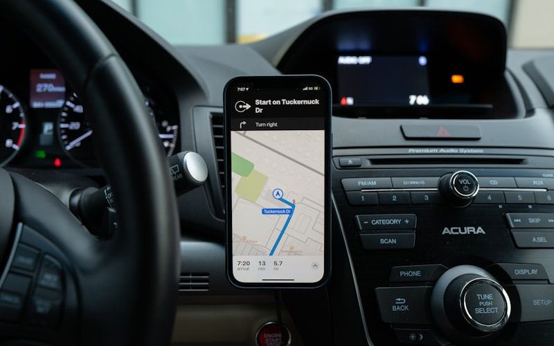
Ever find yourself using GPS while exploring new places? It’s like having a personal tour guide right in your pocket! Whether you’re driving through bustling city streets or hiking up a mountain, GPS helps you navigate with ease. Isn’t it incredible how technology takes something as expansive as outer space and makes it user-friendly for us on the ground? With GPS, the world feels just a bit smaller and a lot more connected. So, the next time your device leads you to a hidden gem, remember the satellites working their magic above!
The Role of Satellites and Receivers
Satellites are like the stars of the show; they’re responsible for transmitting information across vast distances. Picture them as gigantic postmen, delivering everything from weather reports to TV signals, ensuring we stay connected no matter where we are. And then there are the receivers—our trusty sidekicks. They’re the devices, often disguised as phones, laptops, or dedicated GPS units, that pick up the signals sent from these celestial bodies. Without receivers, satellites would just be sending whispers into the void!

But have you ever wondered how they work together? It’s almost like a dance. The satellite sends out a signal, and the receiver tunes in, just like a radio catching your favorite station. This teamwork allows you to navigate unfamiliar roads, access real-time weather updates, or enjoy seamless video calls. Each little beep and chirp of data is an intricate part of modern life, bridging the gap between you and the world.
Think of it this way: If satellites are the orchestra, receivers are the audience, harmonizing to create a beautiful symphony of connectivity. In a world that craves immediacy and efficiency, this duo ensures we stay linked, informed, and entertained, proving that sometimes, the magic lies in the partnership.
How It Provides Accurate Location Data
In today’s fast-paced world, knowing your precise location is like having a secret superpower. It’s not just about getting from A to B; it’s about enhancing experiences, whether you’re exploring a new restaurant, searching for a hidden gem in your city, or even tracking a delivery. So, how does this impressive feat actually work?
Here’s the scoop. Your smartphone is equipped with Global Positioning System (GPS) technology. Think of it as your very own constellation of satellites zipping around the Earth. These satellites send signals down to your device, which then calculates your exact position using some clever math. Isn’t that wild? It’s like having a group of stars collaborating to identify your spot on the planet!
But wait, there’s more! Location data isn’t just limited to GPS. Wi-Fi and mobile networks step in to boost accuracy, especially in urban areas where tall buildings might block satellite signals. They triangulate your position based on nearby hotspots, recalculating in real time, kinda like a helpful friend recalibrating directions when you take a wrong turn.
And don’t forget about the role of algorithms and data analytics! These tech wonders sift through tons of information to fine-tune your location data. Think of it as a master puzzle solver, piecing together various bits of information until it reveals your spot on the map with laser-like precision. It’s remarkable how collaboration between satellites, networks, and data can turn a blurry image into crystal clear clarity!


Ajouter un commentaire